
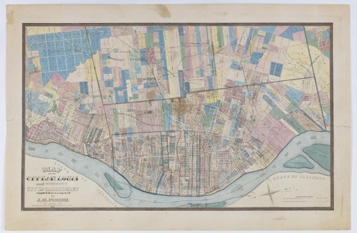
Map of the City of St. Louis and Vicinity. City of Carondelet
Date: 1865
Creator: Fisher, J.H.
Permalink: MOHIST Link
Description:
Very colorful map of St. Louis in 1865. Depicts city limits of 1855. Shows block numbers within city limits; land ownership, survey numbers in parcels outside city limits. Boundaries of townships and wards 1-10 are hand colored. Coverage extends from Mississippi River to River Des Peres on the south, the western boundary of the Gratiot League Square on the west (approximately the present city limits), and the North Missouri Rail Road on the north. Arsenal Island, part of Bloody Island, Kerr’s Island, and Cascarot Island are shown in the Mississippi River. Landmarks include Bellefontaine and Calvary Cemeteries, Lafayette Park, a depot on Poplar between 7th and 8th across the street from Centre Market, Washington Square, Missouri Park and Lucas Market. The County Farm is shown south of Arsenal and west of Kingshighway. Shaws Garden [Missouri Botanical Garden] is shown, but Tower Grove Park does not appear yet. Map has north oriented toward the right.
Last Modified: 12-Sep-2026 08:38


